Thinking about building, repairing, or buying a home with a dock on Saint Helena Island? Coastal projects here are rewarding, but the rules can feel complex. You want safe access to the water and confidence that everything is permitted correctly. In this guide, you’ll learn who regulates docks, what triggers permits, how the process works, key local considerations, and practical next steps so you can move forward with clarity. Let’s dive in.
OCRM and who regulates docks
In South Carolina’s coastal zone, the South Carolina Department of Health and Environmental Control’s Office of Ocean and Coastal Resource Management (OCRM) is the primary state regulator for docks, piers, bulkheads, and work in tidal wetlands and tidal waters. Many projects also need federal review by the U.S. Army Corps of Engineers (USACE), Charleston District, under Section 10 for navigable waters and Section 404 for fill in waters and wetlands.
If a federal permit is involved, a state Section 401 Water Quality Certification is typically required. Beaufort County Planning and Zoning and Building Codes handle local building permits, floodplain standards, setbacks, and inspections. Depending on site conditions, agencies such as the South Carolina Department of Natural Resources, NOAA Fisheries, and U.S. Fish and Wildlife Service may be consulted, especially if essential fish habitat, listed species, or submerged aquatic vegetation are present.
Bottom line: most shoreline projects on Saint Helena Island involve coordination among OCRM, USACE, and Beaufort County. Plan your timeline with that in mind.
What needs a permit here
Activities that commonly require review and permits include:
- New private residential docks, piers, and walkways
- Extensions or major modifications to existing docks
- Boatlifts and boatlift canopies
- Floating docks and seasonal floats
- Bulkheads, seawalls, revetments, and gabion walls
- Boat ramps and associated dredging or fill
- Any work seaward of mean high water (MHW) or into tidal wetlands
- Filling, grading, or excavating tidal wetlands or subtidal areas
Key triggers:
- Work seaward of MHW or into tidal wetlands usually falls under OCRM and often USACE jurisdiction.
- Any fill placed into tidal wetlands or subtidal areas typically triggers Section 404 review by USACE.
- Routine maintenance may be treated differently from replacement in-kind or expansion. Replacements and enlargements usually need full permits. Confirm details with OCRM and USACE before you start.
- Projects that could affect navigation channels, shellfish beds, or submerged aquatic vegetation face higher scrutiny and may require redesign or mitigation.
Permit types and pathways
Your project may fit one of several approval paths:
- OCRM minor or major permits depending on size and impacts.
- USACE Nationwide or Regional General Permits for routine, low-impact projects, or an Individual Permit for larger or sensitive work.
- A state Section 401 Water Quality Certification if a federal permit is required.
- Beaufort County building permits and floodplain compliance before work begins.
The exact route depends on location, footprint, construction methods, and potential impacts on wetlands, habitat, and navigation.
The step-by-step process
- Pre-application check
- Contact Beaufort County Planning and Building and OCRM early. A quick consult helps confirm jurisdiction, submittal needs, and potential red flags.
- Site assessment and data
- Get a survey showing property lines, MHW, tidal wetlands, and water depths. Prepare a plan view with dimensions, walkway alignment, piling locations, distances to neighbors, and construction methods. Include photos and note any visible vegetation or shellfish.
- Applications filed
- Submit your OCRM application with plans, ownership documents, and contractor details. If the project may affect navigable waters or involves fill, file with USACE for Section 10 and/or Section 404 authorization. If federal permits are needed, a Section 401 Water Quality Certification is usually coordinated through the state. Apply for Beaufort County permits for local code and floodplain compliance.
- Public notice and coordination
- Larger or sensitive projects may require public notice and interagency coordination. NOAA Fisheries, U.S. Fish and Wildlife Service, and SCDNR may be consulted.
- Review and conditions
- Agencies typically require avoidance first, then minimization and mitigation. You may see conditions like open-pile designs, reduced footprints, construction timing windows, turbidity controls, or compensatory mitigation if wetlands are impacted.
- Permits, construction, inspections
- Read permit conditions carefully and keep approvals on site. County inspections and final approvals are common before use.
Application materials checklist
- Property survey showing lot lines and MHW
- Scaled site plan with coordinates, dock dimensions, and distances to adjacent property lines and docks
- Elevation and cross-section drawings, plus construction details
- Method statements for pile driving and turbidity controls
- Photos of shoreline and access route
- Ownership documents and any past permits or as-builts
- Environmental information as needed, such as SAV or wetlands delineations
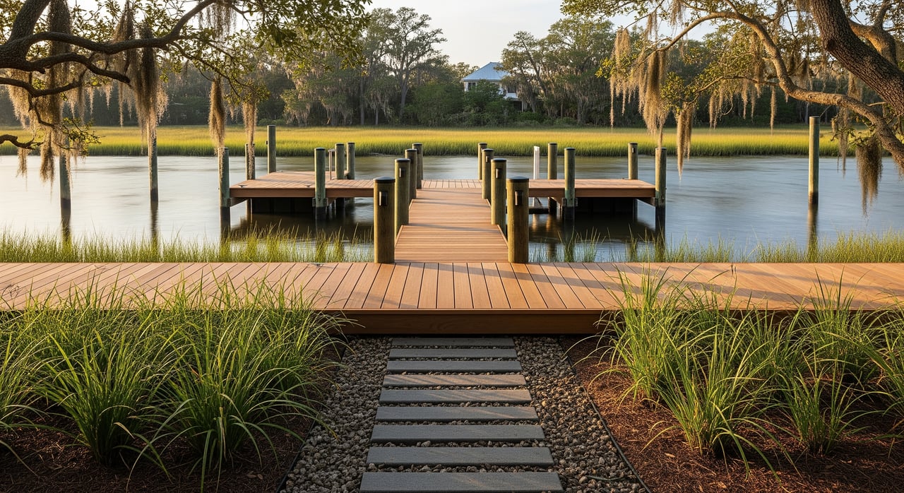
Saint Helena site realities
Saint Helena Island sits within a network of tidal creeks, salt marsh, and intertidal flats that are both scenic and environmentally sensitive. That context shapes design and permitting.
What to expect locally:
- Sensitive habitats: SAV, shellfish beds, and nursery areas are common, which can trigger closer review and mitigation.
- Preferred construction: Open-pile designs and minimal footprints help maintain tidal flow and reduce impacts.
- Seasonal windows: Timing restrictions can protect fish spawning seasons and reduce turbidity during construction.
- Floodplain rules: Many properties are in FEMA flood zones. Elevation standards, piling heights, and utility placement often apply.
- Riparian rights: Upland ownership does not confer ownership of state submerged lands. The state regulates tidelands and submerged lands, so you need permission to place structures waterward of your property boundary.
- Cultural resources: Projects requiring federal permits may need a Section 106 review for historic properties, reflecting the island’s Gullah/Geechee heritage.
- Future conditions: Consider sea level rise and erosion. Designs that are elevated, modular, or adaptable can reduce long-term risk.
Timelines, costs, and planning
Processing times vary with project size, site sensitivity, and agency workload. Typical ranges for similar coastal projects:
- Minor state reviews: a few weeks to a couple of months
- USACE Nationwide or regional verifications: a few weeks to a few months
- USACE Individual Permits or projects with habitat consultations: several months to a year or more
Fees depend on the agency and permit type. Budget for application fees, surveys, environmental reports, potential mitigation, and local permit and inspection fees. Because multi-agency coordination is common, plan for several months for a straightforward residential dock and longer for projects with wetland fill, dredging, or species/historic reviews.
Repairs, replacements, and enforcement
Routine maintenance may have a simpler path than replacements or expansions. Replacing piles in-kind or re-decking can be different from lengthening the dock or adding a boatlift canopy. Always confirm with OCRM and USACE before doing any work.
Unauthorized work can lead to stop-work orders, fines, or requirements to remove structures and restore wetlands. After-the-fact permits may be possible, but they often carry additional conditions and mitigation. If you’re buying a home, verify that any existing dock or shoreline structure is properly permitted.
Buyers and sellers: quick checklist
Sellers
- Gather permits, as-built drawings, and maintenance records.
- Disclose any known issues or enforcement history.
Buyers
- Request permit history and as-builts for any existing dock or bulkhead.
- Confirm permitted status and any conditions or expiration dates.
All parties
- Obtain a current survey showing MHW and tidal wetlands.
- Use licensed marine contractors and surveyors familiar with Beaufort County.
- Plan for permit timelines, seasonal work windows, and weather.
Smart next steps
- Get a recent survey that clearly shows your property lines, MHW, and tidal wetlands.
- Ask the seller or county for past permits and as-builts.
- Schedule a pre-application conversation with Beaufort County and OCRM to confirm jurisdiction and submittals.
- If the project may impact wetlands or require dredging, consult an experienced marine contractor and consider an environmental consultant for SAV or wetland surveys.
- Build a realistic timeline that accounts for multi-agency review and potential mitigation.
If you’re weighing a dock addition, planning to list a waterfront home, or evaluating a property with an existing pier, a local guide can save you time and stress. For neighborhood-level insight and introductions to trusted local resources, connect with the Chambers Helms Group. We can help you navigate due diligence, coordinate a smooth sale or purchase, and align your plans with local permitting realities.
FAQs
Do I need a permit for a small or seasonal dock on Saint Helena Island?
- It depends on size, location relative to mean high water and tidal wetlands, and whether any fill or sensitive habitats are affected. Start with OCRM and Beaufort County for a quick jurisdiction check.
Who should I contact first about a new dock?
- Begin with Beaufort County Planning and Building for local requirements, then OCRM for coastal jurisdiction. If the work extends into navigable waters or involves fill, contact USACE Charleston District as well.
How long does dock permitting usually take?
- Straightforward projects that fit streamlined state or USACE authorizations can take a few weeks to a few months. Complex projects with wetland fill, dredging, or habitat consultations can take many months or longer.
What documents will I likely need for my application?
- Expect to provide a survey with MHW, scaled plans with dimensions and setbacks, elevation drawings and construction details, photos, ownership documents, any prior permits, and environmental information such as SAV or wetland delineations if needed.
Can I transfer an existing dock permit when I buy or sell?
- Some permits are transferable, but rules vary. Ask for copies of all permits and conditions and confirm transfer procedures directly with the permitting agency.
How do flood zones affect dock design?
- Many Saint Helena properties are in FEMA flood zones, so elevation and construction standards often apply to access structures and utilities. County floodplain compliance is part of local permitting.
What happens if my project could affect navigation or shellfish beds?
- Projects that impact navigation channels, shellfish beds, or submerged aquatic vegetation face closer review and may require redesign, avoidance, or mitigation to reduce impacts.